
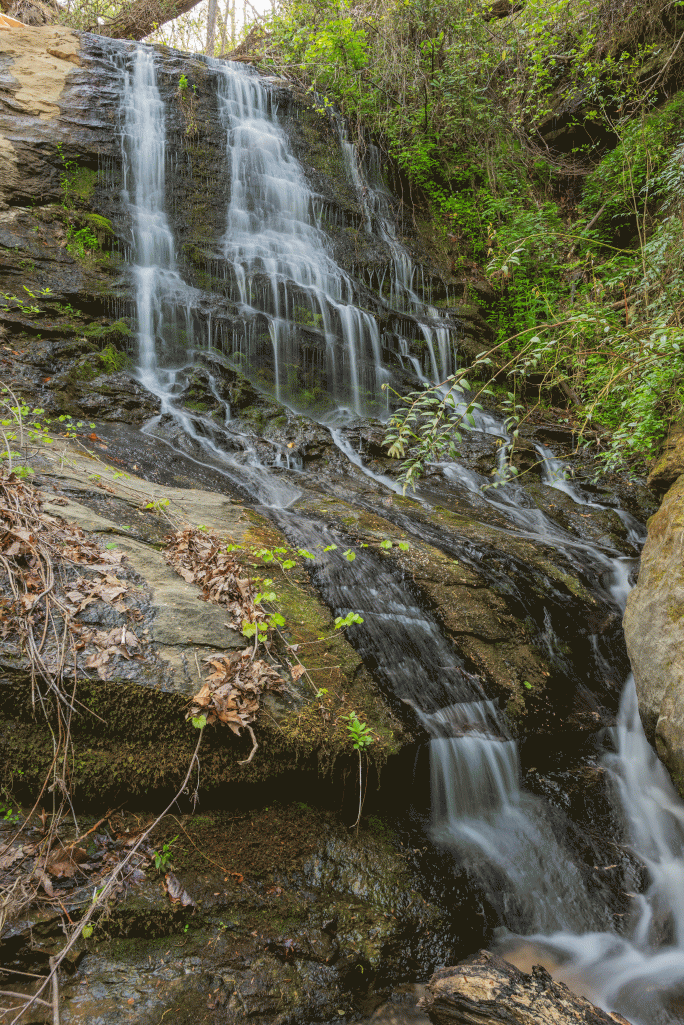
Waterfall GPS: 34.69264, -83.30539
Water source: Unmapped tributary to Boatwright Creek
Waterfall height: approximately 15-20 feet
This waterfall begins a series of small, but very scenic drops, along an unmapped tributary to Boatwright Creek.
These smaller drops are downstream, and most certainly worthy of the time to stop to visit them:


Parking: Going west on Highway 76, turn left onto Brasstown Road. Follow this road until the gate forces you to turn right, onto what the maps show is Glenrhoe Road. Follow this road to the very end and park in the cul-de-sac, GPS 34.69490, -83.30529.
Hike: The hike is a bushwhack through relatively open forest. Map reading skills and experience in off-trail hiking is required. Mileage will vary depending upon your route, but it is a very short trek, though steep in places.
