
Waterfall GPS: 34.77831, -83.22977
Water source: Unnamed tributary to the Chauga River
Waterfall height: approximately 45 feet in total
Upstream from Joney Woodall Falls sits this two-tiered waterfall where the stream makes a sharp left turn. The rock wall here is as impressive as the waterfall itself, towering high above the water. Unfortunately, there is some downfall on the falls, making decent photos nearly impossible. It is also not possible to see the entire drop from the base, but you can catch glimpses of it through the trees as you approach from downstream. These are cell phone shots, lower drop first, and then the uppermost drop:
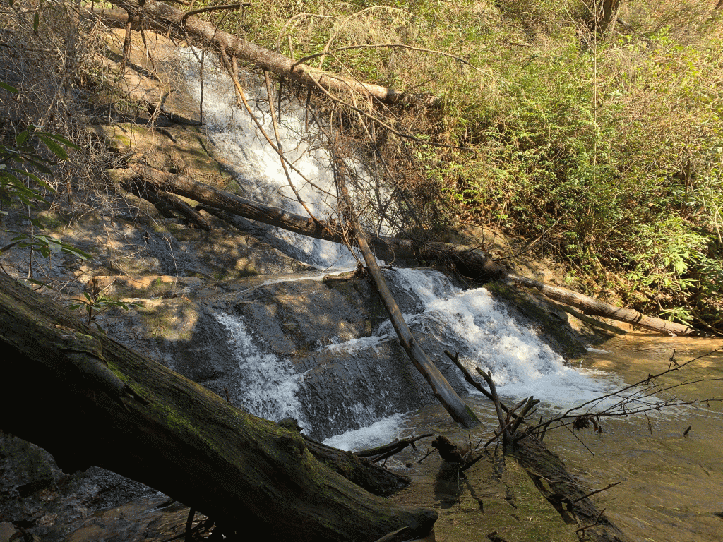

There is no trail to this waterfall, and it is definitely best seen after a period of heavy rain. The rhododendron and briars surrounding the falls are thick, and the terrain by the falls is steep. While these cell shots fall far short of showing how big and impressive this waterfall is, it is definitely one that avid waterfallers experienced in off-trail hiking will want to add to their list!
Parking: There are two options for parking, depending on which route you choose to approach this waterfall. Option 1: Going north on Highway 28, turn left onto Whetstone Road. In approximately .7 mile, turn left onto Cassidy Bridge Road. Drive for approximately 6.7 miles, and turn left onto Double Branch Road. Go to the end of the road and park, GPS 34.77554, -83.22411. This is the parking and trailhead for Joney Woodall Falls. Option 2: Follow previous directions, and along Double Branch Road, park at or near GPS 34.77859, -83.22733.
Hike: Option 1 for this hike is to hike to Joney Woodall Falls, and then continue upstream to the upper falls. Going this route, and then hiking up to Double Branch Road and back to the car from there, makes the hike approximately 1.7 miles total. Option 2, if Upper Joney Woodall is your only destination, is to make the short bushwhack from Double Branch Road down to the falls. Please note that experience in map reading and off-trail hiking are recommended for this hike. The area immediately surrounding the falls is incredibly thick and dense, so extreme caution is necessary.
