
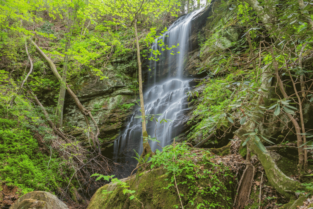
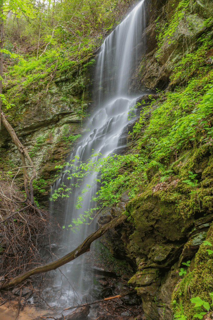
Waterfall GPS: 34.68985, -83.30536
Water source: Boatwright Creek
Waterfall height: approximately 50 feet
It only seemed fitting to name this stunning waterfall on Boatwright Creek after my dear friend, Bernie. He’s a legend among waterfallers, and his contributions to the waterfalling community are without measure. This is a small way for Oconee County to say thank you for those contributions.
Parking: Going west on Highway 76, turn left onto Brasstown Road. Follow this road until it forks – both forks are gated. The right fork leads up to the Pine Mountain tower. You will park at the left fork, at GPS 34.69570, -83.29453.
Hike: Begin the hike by walking the length of the old forest road. When the road ends, continue to follow the slope of the ridgeline, avoiding the steep ravines on either side. To your right, you will hear the Waterfall on tributary to Boatwright Creek, but this is much easier accessed from the directions in its listing. Continue along the ridgeline through relatively open forest to around GPS 34.69234, -83.30476. Here, you will want to make a left, heading towards the waterfall. The final descent to the waterfall is incredibly steep, and bringing a rope is suggested to make it easier, as the terrain is quite soft and slippery. Map reading skills and experience in off-trail hiking is required. Mileage will vary depending upon your route, but will average approximately two miles round trip.
