
GPS for waterfall: 34.85813, -83.24155
Water source: Whetstone Creek
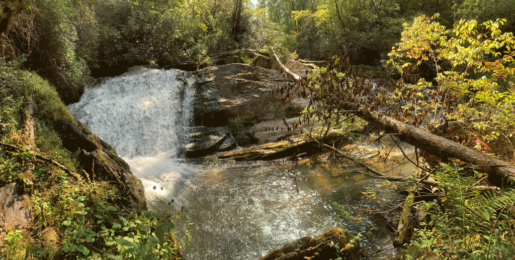
Waterfall height: approximately 15 feet
This waterfall unfortunately has some downfall, which prevents a decent camera shot. It’s a very wide and very beautiful waterfall, with the water falling on either side of the massive rock. UPDATE: As of February 2025, it appears that some of the downfall has washed away.

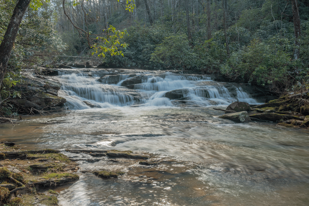
Upper Whetstone Falls is upstream from the more well-known Whetstone Falls, which really is more of a cascade. Whetstone Falls is an easy half mile trail walk, where there are also views of the Chattooga River.
Parking: Going north on Highway 28, turn left onto Whetstone Road. At the four-way stop, continue onto Earls Ford Road for approximately 3 miles, and turn left onto Sandy Ford Road, which is FS 721-A. Follow Sandy Ford Road to the end and park, GPS 34.86012, -83.24218.
Hike: There is no trail to Upper Whetstone Falls. It is a short, relatively easy bushwhack that begins just left of the trail to Whetstone Falls. Depending on your route, should only be around three-tenths of a mile round trip. Knowledge in map reading and off-trail hiking is required for this hike.
