GPS for waterfall: 34.75472, -83.30871
Water source: Opossum Creek
Height: Approximately 55 feet
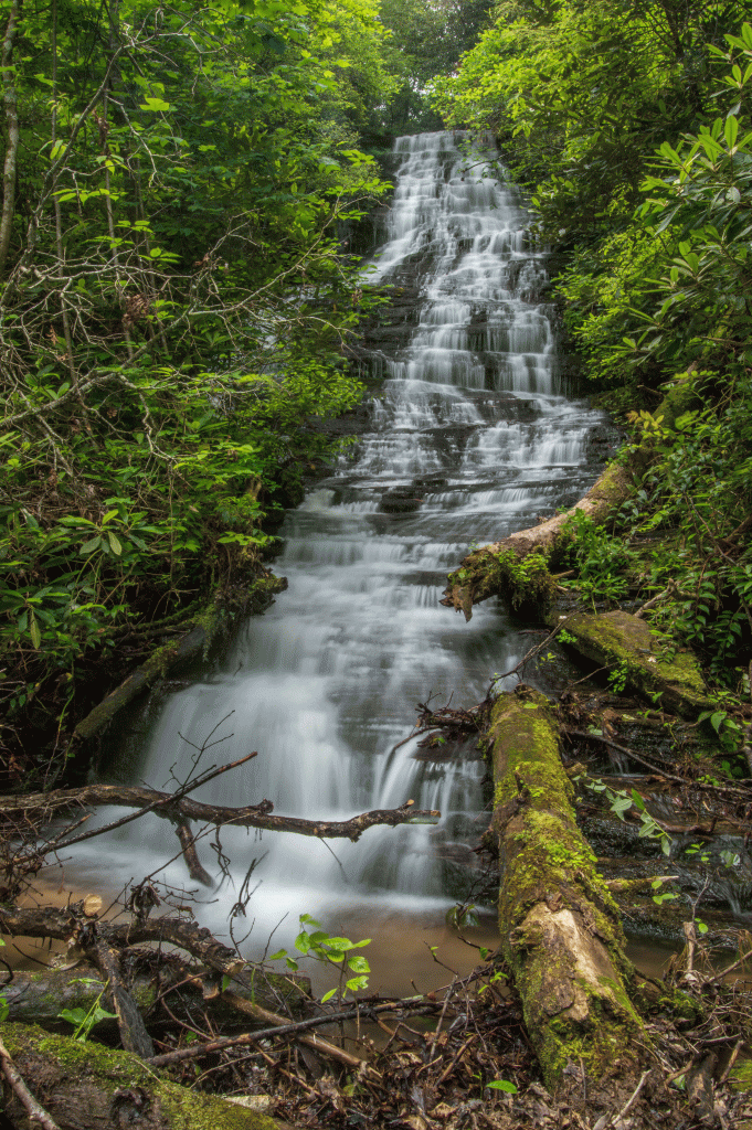

This uppermost waterfall on Opossum Creek sits nearly side-by-side with Sid’s Falls. Because of its close proximity to Sid’s, the waterfall community opted to name this waterfall after Maxie Duke, as she and Sid Ballenger were Oconee County’s waterfall pioneers.
Parking: Going west on Highway 76, turn left onto Damascus Church Road. Go right at the intersection at Chattooga Belle Farms, staying on Damascus Church Road. At the stop sign, make a right. Drive for approximately .8 mile, and park in front of the gate to the old logging road. There is a church just ahead on the left, so you know if you’ve reached the church, you’ve gone too far. Parking GPS is 34.74179, -83.29897. This is the same parking and trailhead for Sid’s Falls and Sparkle Falls.
Hike: This hike follows the trail to Sid’s Falls until the last tenth of a mile or so. Follow the logging road, through the fields, and then into the woods on the narrow trail. At around 34.75495, -83.30764, the trail makes a right and begins the steep descent down to Sid’s. At around 34.75553, -83.30837, leave the trail for Sid’s and head left (it’s an obvious path). From the point you leave the trail, it is a steep descent and bushwhack down to Maxie Duke Falls. It is just over 1.5 miles (one way) to Maxie Duke Falls.
**UPDATE** As of February 2020, there is a decent, fairly easy to follow scramble path to the base of the falls. Thank you to the person who took the time to do the trimming and cutting! Note that it is extremely steep and slick in places. It is roughly .2 mile to the base of Maxie Duke Falls.
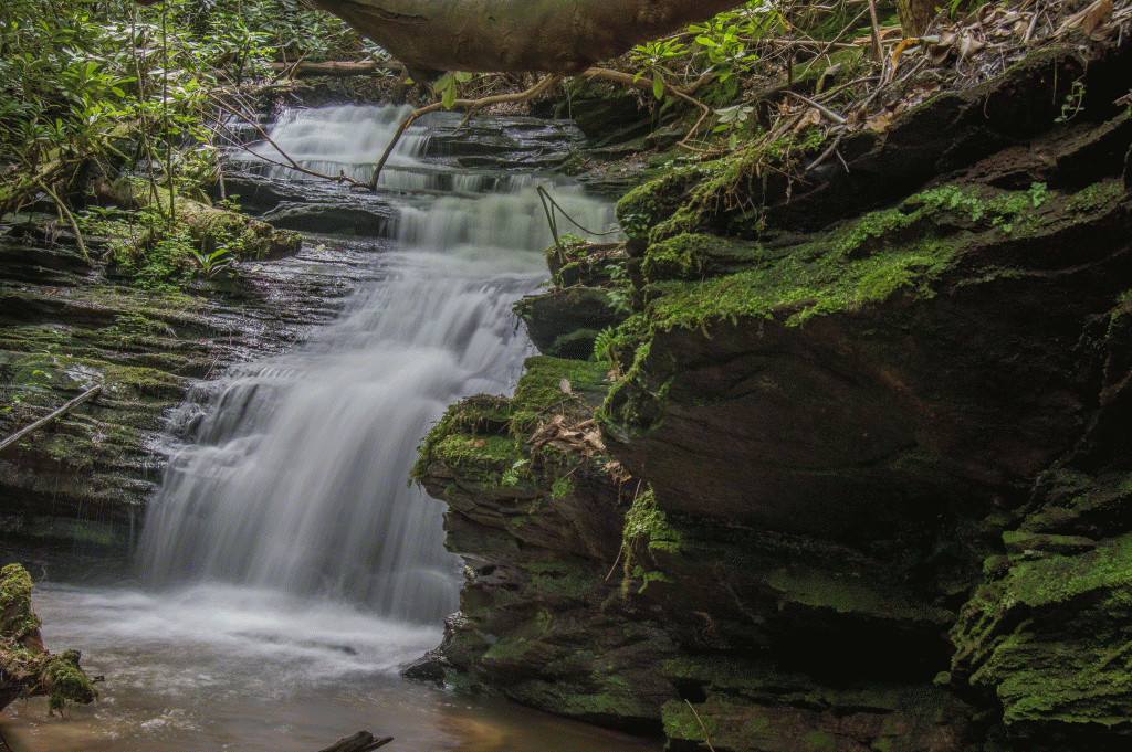
Below Maxie Duke Falls, at 34.75506, -83.30978, is this beautiful 15-ish foot drop with a captivating moss-covered rock wall: